Around Buková
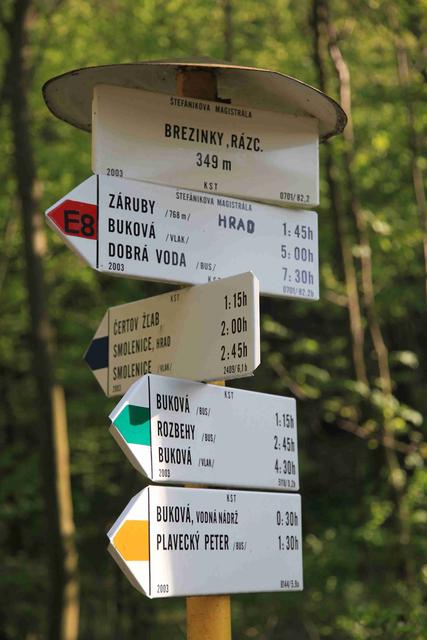
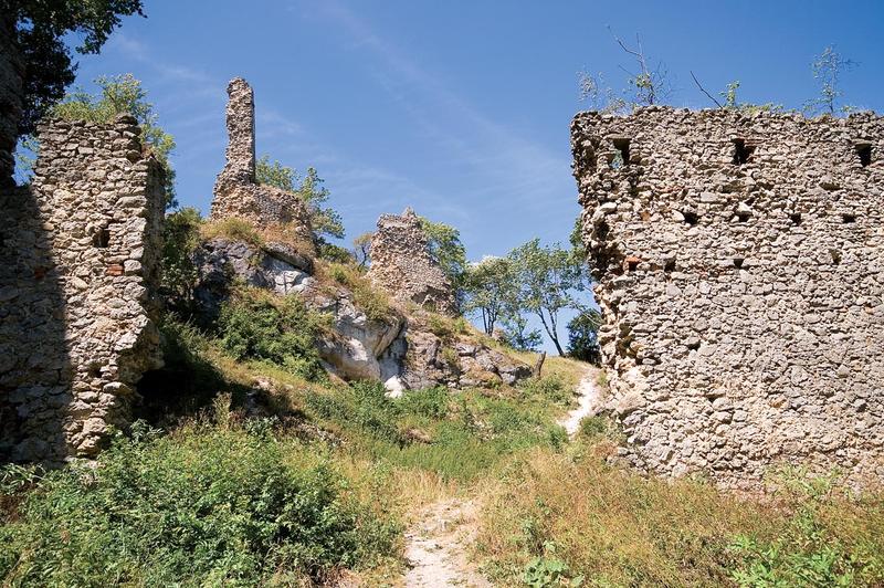
This undemanding half-day hike has a small elevation gain and easy orientation. We set off taking the green trail from the middle of Buková village (321 m) eastwards to the Horné Kopanice settlement. We descend close to Trnávka stream, under the rocks, and we come to the upland Rozbehy village. Turn left at the crossroads following the blue trail markers and go towards the Korlátka cottage at the upper end of the village, following the yellow trail markers. A trail towards Korlátka Ruin continues to the right from the cottage. Take the same route to get to the upper end of Rozbehy. The blue trail markers will take us to Vápenková skala. Behind it, pass through the meadows over the Lieskovské Kopanice settlement on the edge of the forest. Behind the crossroads under Hrubý Kamenec, we go around the peak of Hrubý Kamenec, identifiable by the telecommunication tower, using a short forest section of the trail, and we descend to cottages at the western bank of the Buková water reservoir. Bypass the water reservoir from the south following the yellow trail markers. Turn right at the narrow trail heading towards the paved road leading to the Breziny trails crossroads. We descend to the village of Buková taking the green forest road, circumventing the foothill of Záruby massive.


Contact
Around Buková
Buková